Roy L. Davis II becomes Graduate I,
and departs from the department.
Later, Dr. Davis looks back and reflects.
Roy L. Davis II becomes Graduate I,
and departs from the department.
Later, Dr. Davis looks back and reflects.
Roy spent plenty of time in the laboratory quantifying Fusarium oxysporum f. sp. vasinfectum (Fov) DNA from field soil, and some of his work is now reported in a Plant Disease publication: https://doi.org/10.1094/PDIS-08-21-1664-RE
The work’s objective was to describe spatial variability in Fov inoculum density in the field, because that variation is hypothesized to affect risk of cotton plants expressing Fusarium wilt disease. Much of Roy’s report concerns development of the quantification method, which targets the Fov race affecting the selected field sites. Roy discovered that inoculum density varies across the field space by orders of magnitude (shown in the figure below, where “inoculum level” is a relative logarithmic scale), and by observing it at multiple time points he noticed a temporal pattern: inoculum density trajectory depends on growth resource type and availability, which depends on prior inoculum density. Roy is now finishing documentation of that cycle in this system.

Roy, Jensen, Manjari, and Tim all presented posters of their research at the 2022 PLPM Graduate Research Showcase.

Roy was invited to present his work at the Conference on Soilborne Plant Pathogens held virtually on March 22 and 23, 2022. He presented research related to his work with the spatial and temporal variation of FOV4. Roy was also one of four recipients of the Martin Stoner Memorial Fellowship.
Roy presented his research at the 2022 Student Research Week (SRW) held at the Memorial Students Center at Texas A&M University. His presentation won first place in the Graduate Oral Presentations in the Agriculture division.
Roy presented his research virtually to an audience at the 2022 American Phytopathological Society Southern Division Conference in Chatanooga, TN.
Roy successfully defended his dissertation, titled “Characterizing Inoculum Density and Plant Phenotypic Variation At High Spatial Resolution”, on March 9, 2022.
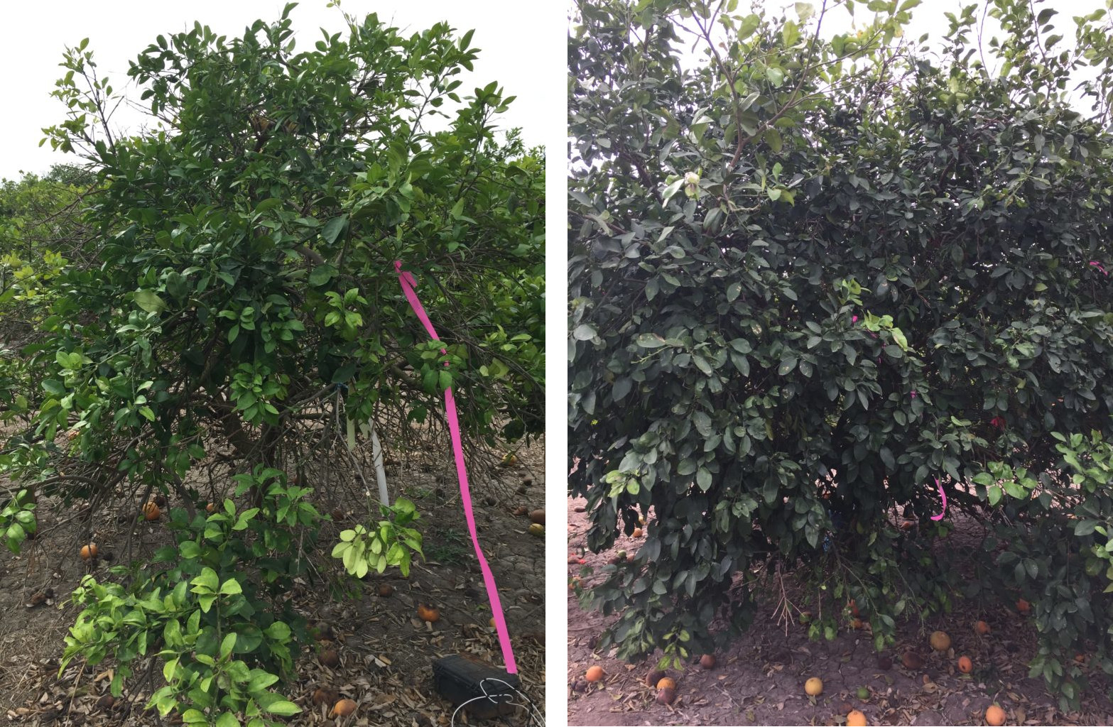
I recently started research focusing on citrus greening and inoculum density. In the left picture, Candidatus Liberibacter asiaticus (CLas), the presumed causal agent of citrus greening, was first detected 6 years ago. The right picture shows a more recent infection first detected in 2020. The damage from a long-term infection is apparent between the two pictures where there are fewer leaves and the difference in the color of the leaves.
I went to the Citrus Center in Weslaco, Texas, to set up data loggers and collect samples. Data loggers will be used to record soil and canopy temperatures. The data from these loggers will be interesting as they were set in place shortly before Winter Storm Uri, which is likely to have affected citrus trees.
Roy’s collaboration with other researchers using unmanned aerial systems led to an application recently published in Agronomy. doi: 10.3390/agronomy10050633
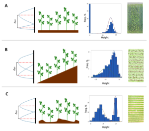
Roy set out to make use of available low-altitude remote sensing data. Available data are often more useful than unavailable data, in practice.
Work led us to recognize that data generated through LARS are different from data generated by walking in a field with a ruler in two fundamental (that’s a pun) ways: first, LARS data aren’t calibrated in the way that ruler measurements are; second, LARS data points come in by the million at today’s image resolution, and no one with a ruler takes that many measurements. Convention is to calibrate LARS data against the ground in a way similar to how people do it with rulers: the ruler doesn’t allow you to differentiate the ground from your measurement target, so you classify plants vs. ground by another process, involving your recognition of patterns based on colors, shapes, and your heuristics. This process for LARS-based estimation can use global positioning systems, computer vision, or other things that have lots of potential.
Roy asked, can we estimate plant heights accurately without calibrating LARS data against the ground through other means? Can we apply a heuristic to the data after they’re collected and estimate plant heights without knowing which distance-from-the-drone recordings are for the ground vs. the plants? The answer is yes, so long as you have data of the type and quantity provided through LARS, and that answer is detailed in his paper. Roy is also good at making schematics – here’s one that shows how images, values, and interpretations correspond in his technique: